Where Threatened Waters Flow (2006)
Last modified: 13th February 2020
Anchorage, Alaska: As we tossed our hiking gear into the small, cargo-stuffed plane that would take us to Nondalton, I got a few last-minute pronunciation lessons from the pilot.
“It’s Tal -AIR-ik, not TAHL-a-rik,” he corrected me. “And Iggy-AH-gig, not I-GOOEY-gig”.
I thanked him, repeating the words in my head. I knew a few words couldn’t transform me into a local, but I didn’t want to sound like I was reading straight off the map.
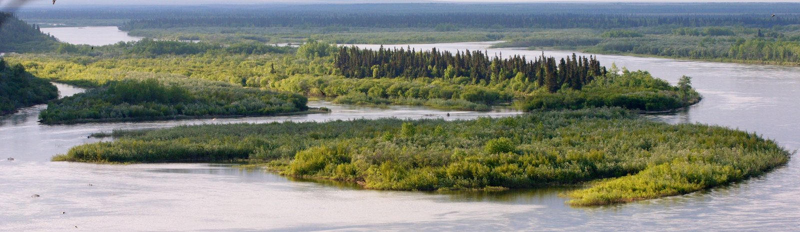
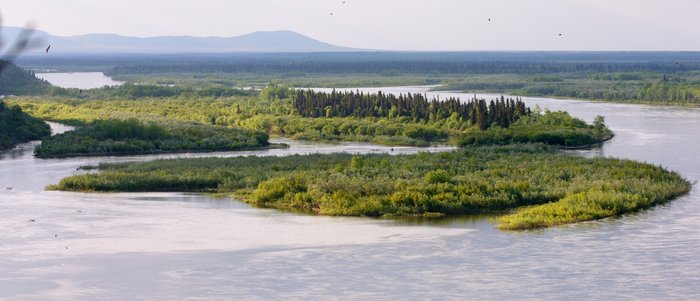
Upper Talarik Creek and Igiugig village lie in the Bristol Bay region of Southwest Alaska. Here wide forested rivers snake through a landscape of rolling tundra, carrying millions of salmon from the Bering Sea. Hundreds of miles off the road system and home to only a few thousand people, most people eating Bristol Bay salmon have never heard of this far-flung and wild corner of the country.
It may not remain wild for long. Hidden deep beneath the tundra, a legacy of the land’s volcanic heritage, lie billions of dollars worth of copper and gold. Mining companies across the world are turning their sights on Southwest Alaska.
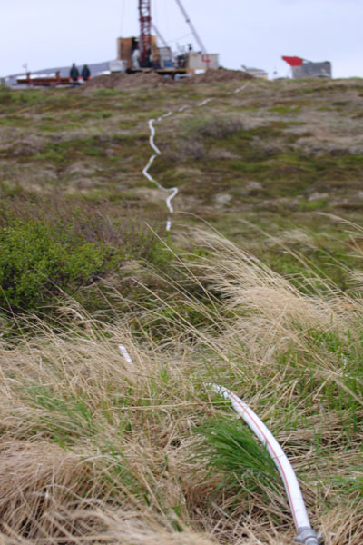
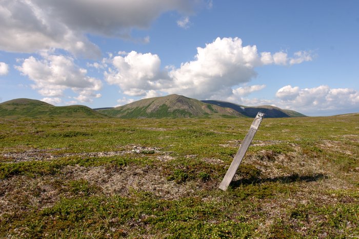
Sixteen miles from Nondalton village, low rounded mountains surround a glacier-carved valley. Hundreds of shallow lakes and ponds sparkle in the wet tundra that blankets the valley floor. Until a few years ago, few outsiders had ever visited the Pebble valley. But today, survey helicopters roar overhead and scattered drill rigs tunnel deep into the rock.
Northern Dynasty Minerals, a company based in Canada, has poured millions of dollars into the exploration of this remote valley. If the company has its way, it could soon be home to the Pebble Mine, the largest open pit mine in North America.
According to the Environmental Protection Agency, hard-rock mining is by far the most polluting industry in the country. Many supposedly “safe” operations have caused disastrous spills and leaks into their local waters. At the Pebble claim, drill rigs perch between two knee-deep creeks. Hundreds of miles later, these creeks empty into Bristol Bay as two great rivers, the Nushagak and the Kvichak. Situated on a low divide between two of the most productive salmon rivers in the world, the Pebble project is uniquely placed to threaten an economy, a way of life, and one of our last great wild ecosystems.
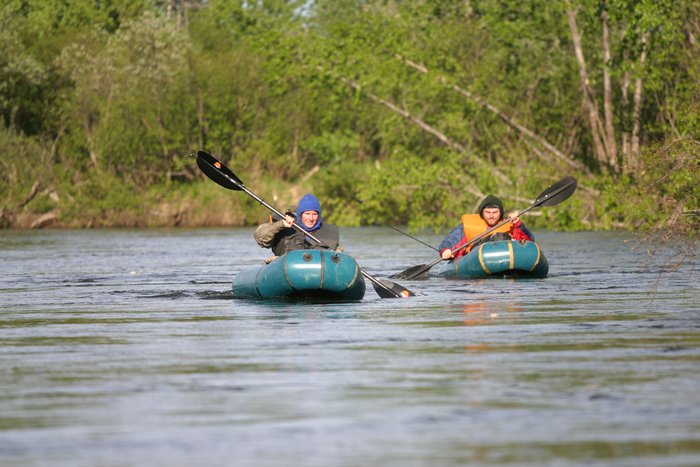
My mission on this journey was to follow the water. Along with my husband Hig, and my friend Tom, I had arrived in this wilderness with a camera, a backpack, and a month to explore the world that the Pebble Mine would threaten. As salmon swim, and as toxins might flow, we intended to travel almost 500 miles under our own power, hiking and packrafting the length of both watersheds.
It was early June when we walked out of Nondalton village. The tundra was painted with the pastel yellows and pinks of tiny wildflowers and tinged with the dull, muted tones of ground that has only recently emerged from the snow. My back twinged uncomfortably beneath a pack full of food and camera gear, not yet accustomed to the load.
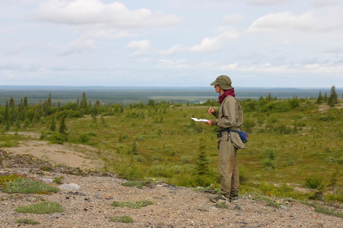
Even from this closest village, the Pebble valley was still a day and a half’s walk away. As we approached the first of the exploration drill rigs, a trio of caribou trotted past gracefully, too fast for my camera. A helicopter roared across the dark grey sky, tilting and bouncing in the punishing wind. Trash littered the ground near the trampled and muddy pits of old drill rig sites. One gave off a distinctive smell of oil.
Nervous about what Northern Dynasty’s workers might think, I crouched in the grass with my telephoto lens, shooting drill rigs and hoses, and the sludge of rock slurry spilling out over the tundra.
But we had little time to investigate. The threat of this project stretches much farther than the Pebble valley, and we still had over 400 miles to travel. Turning our backs on the drill rigs, we followed the meanders of the Koktuli River as it turned away from the potential tailings lake and headed out between the hills.
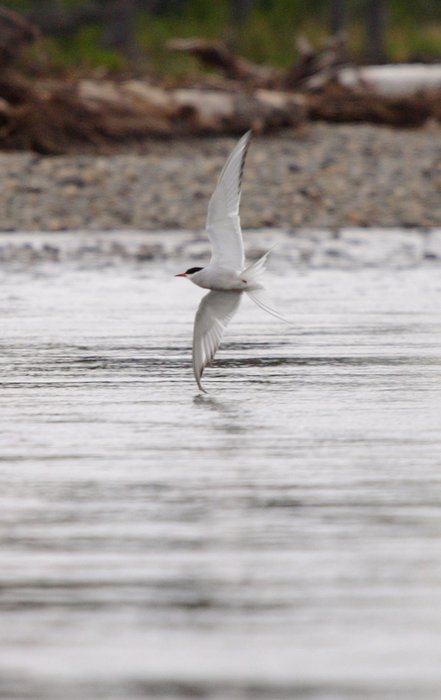
Over the next several days, we let the wind and the current carry us down from the Koktuli, to the Mulchatna, to the Nushagak, along an ever-growing river. From open tundra, the river led us through scraggly willows into a forest of spruce and cottonwood. Eagles perched on the tops of the tallest trees, attempting to look regal as they fought the buffeting wind. Swallows zoomed in and out of their homes in the bluff, bringing home a new mosquito for their offspring every few seconds, but somehow never exhausting the buzzing supply. Arctic terns dive-bombed us in the cotton grass fields, protecting their nests. Skittish moose mothers bolted almost as soon as we caught sight of them, while the large bulls merely glared at us between mouthfuls of willow.
With its abundant moose and caribou - it is home to the 100,000-strong Mulchatna herd – and a sizeable population of brown bears, this region supports many of Alaska’s largest and most charismatic animals. But to the people that live here, the most important animals of all were those swimming beneath our boats.
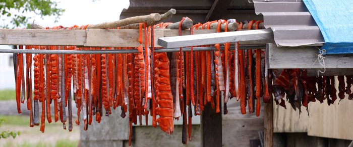
June on the Nushagak is marked by the beginning of the king salmon run. First and largest of the millions of salmon that swim up the river each year, the kings were struggling up to the village of New Stuyahok just as we reached it floating down. Salmon strips dried on racks on the shore, as four-wheelers pulled wagons full of fish along the bumpy dirt streets. Skiffs zoomed up and down the river, tending subsistence nets, while the owners of sport fishing lodges scrubbed and hammered, preparing for the first clients of the year.
I’ve always been a little shy, and as we paddled the last yards into New Stuyahok, I psyched myself up to start talking.
“Hi…um, well, we just came from Nondalton. We hiked over to the potential Pebble Mine site, and then we’ve been floating in our little rafts, down to here…” I fumblingly explained to the first person we talked to, fishing a grubby map out of my pocket.
Recognition spread across his face. “You guys are the ones from the paper! I’ve been wanting to talk to you. I didn’t expect you for another couple days,” he exclaimed.
“The river was faster than we thought,” I explained, somewhat floored by the recognition.
Though I knew we were in the local paper, the Bristol Bay Times, and though I was even at that moment scheming to find an internet connection to send them an update on the trip, I wasn’t quite prepared for the fact that people would actually read it.
We began to talk to the locals - about the area, about our trip, about the mine. Each person we spoke to seemed keen to tell us that their entire village was against the mine. They were concerned about the fish, and skeptical of the mining company’s promises. But more than anything else, they told us about how much they loved their wild home.
It was easier to understand their reasons than it was to explain our own. After listening to hurried explanation of what we were doing, the New Stuyahok environmental coordinator broke in with a question. “Who are you with? I mean, who is funding you?”
“No one,” I answered. “I mean, we’re just sort of doing this on our own. Self-funded. But it’s not really very expensive to walk…”
It was a question I’d tripped over a few times already, with reporters from the Anchorage Daily News and the Bristol Bay Times. By trip’s end, I realized what I should have told them: Yes, we lived thousands of miles away, but we were sent by no organization. Though we are anything but rich, we were funded by no one, traveling simply and cheaply under our own power. This place may be home to Alaskans, but I care about it too. And although the locals stand to suffer the most immediate impacts if the mine is built, this issue is much bigger than just Southwest Alaska.
drill rig and hose at the Pebble site
The gold and copper under the Pebble Mine prospect isn’t a new discovery. Like many claims in the region, the Pebble deposit has been known about for decades. The reason this battle has erupted now has nothing to do with the people of Southwest Alaska, and everything to do with the rest of us, the consumers and investors.
In the national consciousness, hard-rock mining is oil drilling’s forgotten cousin. Most mines are built in remote areas, far away from the view of most consumers. And the metals they produce pass through a dizzying array of middlemen before ending up in our stores, long severed from the name of the mining company that produced them. Demand for gold comes largely from our appetite for jewelry. Demand for copper comes from all sorts of industries. But more than any demand, what drives new mining is the fickle whims of the stock market. Global commodities prices have increased dramatically in the past several years. As prices go up, it becomes economical to mine ever lower-grade ore, in ever more remote places. The fate of the tundra, of the rivers, and of the salmon is decided by worried investors thousands of miles away, reading about how gold is a “safe investment.”
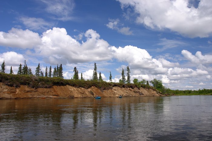
But as we were pulled away from the villages by the fast current of the Nushagak, trying to match up bends on our map with bends in the river, concerns about gold prices faded away behind the immediate realities of current and flow. The forests and fish camps zipped by in a blur of rain and mosquitoes as the water picked up speed, hurrying us toward the sea.
Commercial salmon fishing was in full swing when we hit Bristol Bay in mid-June. The docks at the Dillingham boat harbor were stacked seven deep with fishing boats, dashing out and back for every opener. Launching our tiny packrafts there a few days later, we had a number of onlookers, cheerily forecasting our deaths as we left with the outgoing tide. I think they were only half joking.
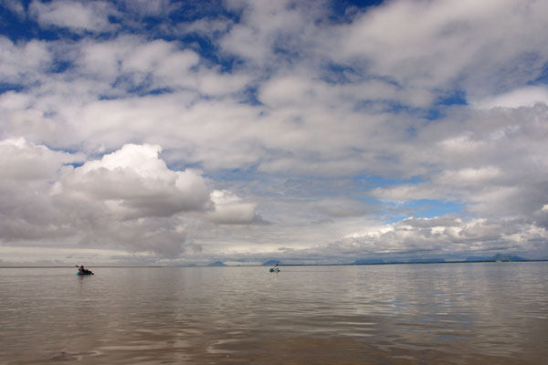
packrafting Bristol Bay near Dillingham
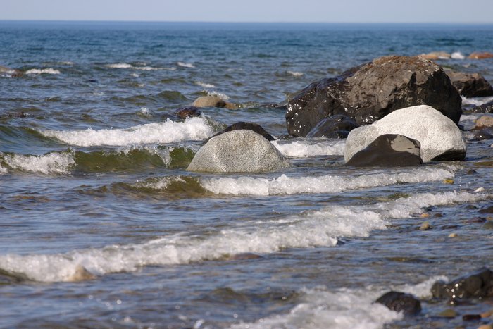
The tide carried us as far as Clark’s Point, a dilapidated-looking cannery village with a large number of ocean-battered buildings. Four-wheeler tracks crisscrossed the beach, which was littered with the discarded heads and eggs of salmon. We rolled up our packrafts on the gravel shore, and walked out towards the open coast.
The beach was gorgeous – hard clean sand and gravel framed by bluffs of peat. A warm sun shone down between drifting clouds, the ocean was calm and glassy, and there was just enough breeze to clear the bugs away.
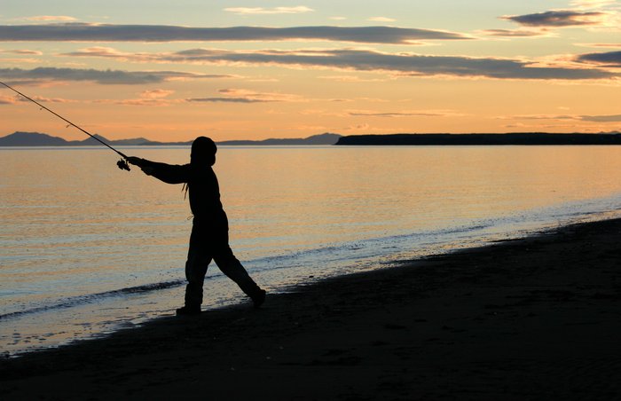
FISHING ON THE BRISTOL BAY COAST
 — 
<a class="figure-caption__link" href="/photos/fishing-on-the-bristol-bay-coast/">Get Photo</a></figcaption></figure>The Bristol Bay coast zipped by in a series of strangely unreal days. Tracks of bears replaced those of four wheelers, and ruins of old cabins toppled off the eroding bluffs. At low tide, the sea disappeared entirely beyond miles of shimmering mud flats, and the coastline was so smooth that we rarely knew where we were with better than five mile accuracy.
And then our beautiful beach ended abruptly in a deep muddy slough and a pod of beluga whales. The belugas frolicked in the water, hissing water from their spouts, calling to each other with their eerie whistles, and snapping up the first wave of sockeye salmon struggling up the Kvichak River. We had turned the corner in our month-long journey. Now, with the salmon, we would be following the water upstream towards the proposed mine. Unfortunately, upstream is the more difficult direction.
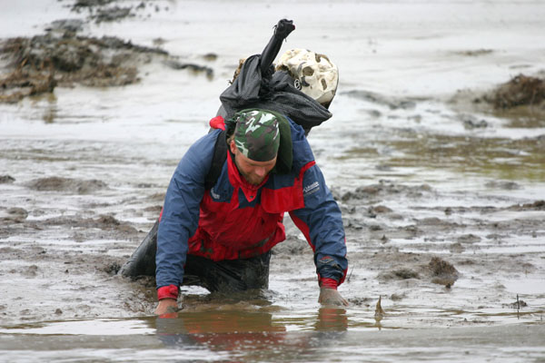
stuck in the mud on the Bristol Bay coast
“I’m stuck!” Tom cried from the middle of a channel, thigh deep in thick, gloppy, sucking mud.
“That’s ’cause you’re carrying too much!” I laughed. “Just crawl out!” I suggested, as I made my own way on hands and knees to the nearest patch of dry ground, stripping off my mud-gooped gloves to snap pictures of the still-stuck Tom.
“These will be perfect for the paper,” I smiled, as he struggled to crawl up the other side of the channel.
He muttered a few unprintable comments in my direction and heaved himself up on the bank
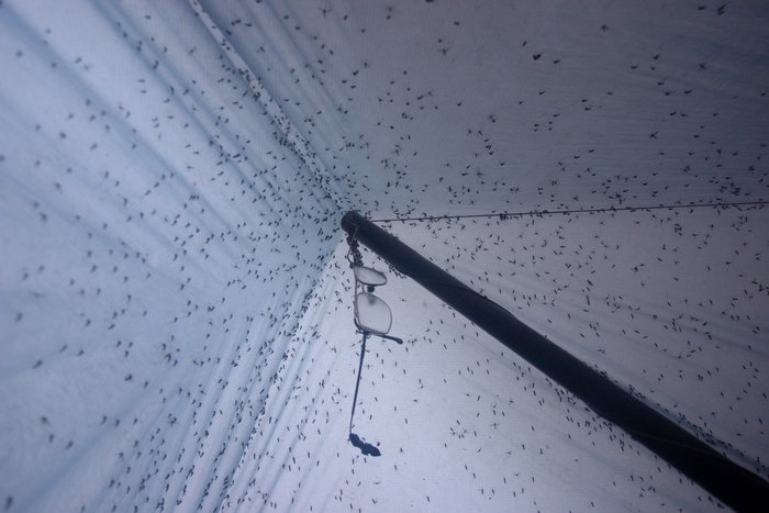
Traveling up the Kvichak River proved to be the most difficult leg of the trip. Our packrafts were no help, and though we left the worst of the mud behind on Kvichak Bay, thick clouds of mosquitoes hovered over the shores of boggy tundra. On a lucky night, we could seal the edges of our tarp with sand or rocks and keep the buzzing outside. On the rest of the nights, we woke to a roof black with thousands of mosquitoes, struggling to escape.
Perhaps it was the featureless landscape. Perhaps it was the marshes. Either way, when we saw the words “exposed rock” scrawled on our map, we reacted as if it had said “pot of gold.” It seemed as if I’d spent more time staring at the little red compass needle than at the spruce and tundra around me, and my thoughts swirled with numbers and directions: “Walk at 110 degrees until I hit the lake. Is that the right lake? There are thousands of lakes. Walk east. Find the lake I thought I just left. Walk at 60 degrees… Will I ever find my way out of this monotonous forest?” The thought of a view from a bare ridge top was incredibly enticing.
After hours of toil through swamps and mosquitoes, we finally shuffled onto a gravelly hilltop. It was 3AM. The view was decidedly dark, and the wind threatened to blow over our hastily constructed shelter. But the lights of far off villages twinkled on the horizon, and I was grateful for the hill’s relative lack of mosquitoes.
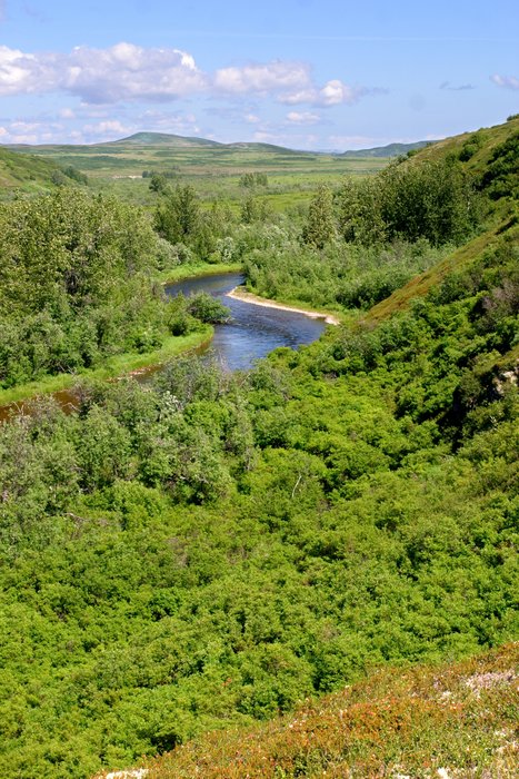
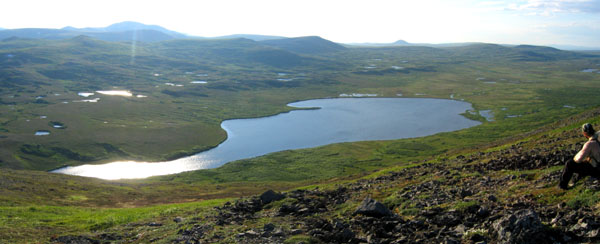
Perched on top of this moraine the next morning, I looked out over the landscape left behind by the glaciers that had once flowed here. Yellow wildflowers poked out from the stones at my feet. A few miles away, the Kvichak River shimmered where it peeked from gaps in the hills. In between was a rolling plain of cotton grass meadows and black spruce forests, pocked with the hundreds of shallow lakes carved out by the ice.
Back along the Kvichak, we slogged through the marsh at the edge of the river, using our packrafts to ferry across the deepest creeks. The Kvichak’s waters were stunningly clear. As we approached Igiugig village, fishing lodges started sprouting along the banks. A dozen wader-clad men stood on the shore by the Fisherman’s Lodge, casting for the first of the sockeyes swimming up the river. I wondered how long it had taken those salmon to reach here from Bristol Bay. Exhausted by our own upstream struggle, I felt I had more in common with the fish than the fishermen.
The last leg of our trip took us along the shores of Lake Iliamna and Upper Talarik Creek, completing our loop back to the proposed mine site. The weather and the landscape seemed to pull out all the stops for us, as if determined that we would go home with the memory of just how gorgeous this region could be.
“That was so much fun!” Tom exclaimed, coming back to our small fire after several hours of fishing in the knee-deep surf of Lake Iliamna. “The water’s so cold, I can’t feel my legs at all anymore,” he added, grinning.
“But you didn’t catch anything?” I asked.
“No, I had this one bite but…” He eagerly recounted a tale of a big fish hooked and then lost.
I like to eat fish, but I will never understand fishermen.
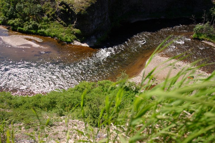
Upper Talarik Creek was the last leg of our long circular journey. Familiar mountains rose in the distance ahead, dividing us from the Koktuli drainage, and marking the valley where the mine would be built. We took a long and circuitous route upstream, repeatedly driven from the water’s edge by a mass of thick brush, only to be drawn back from the high ridges by an enticing sparkle of blue. Rocky cliffs poked out between the alders in a mile-long gorge, and we waded the crystalline shallows beneath them, feasting on grayling from the pools. Where the creek widened, beavers dammed the flow into thigh-deep ponds, stagnant and warm from the sun. We waded through them to the west side of the creek and began to climb, following long slopes of tundra up to the peaks overlooking the prospective mine site. It was a strikingly beautiful place.
Northern Dynasty has promised to “stay out of Upper Talarik Creek” – a trophy trout stream and important spawning area. But this apparently doesn’t extend to a mine pit overlapping the stream’s headwaters, or removal of its water for use in mining operations. In reality, Northern Dynasty’s plans and promises mean little. As an exploration company, it will turn over actual development to another, as yet unknown, corporation, which will not buy the promises along with the gold.
Pebble is the center of a modern-day claim rush. Mining claims are spreading like a cancer in all directions from the Pebble valley, stretching over 540 square miles. These claims are on state land, but the BLM is hurrying to get in on the action, proposing to open most of its 3.6 million acres along the Nushagak and Kvichak Rivers to hardrock mining. Northern Dynasty Minerals is the first company to make a serious effort to develop a mine here, but both supporters and opponents believe that what happens at Pebble will have implications for the whole region. Infrastructure for one mine would allow the development of others, creating a massive Bristol Bay mining district.
overlooking Pebble Mine site
From the ridge overlooking the vast Pebble valley, it was hard to imagine this being a small piece of anything. If Pebble Mine is built, great walls would reach 750 feet above the valley floor on both sides, damming off a tailings lake over eight square miles, with dams larger than the Three Gorges Dam in China. The proposed pit would reach down further from the valley floor than the mountains reaching up alongside it. On the peak where I was standing, toxic water might be just about lapping my toes.
The next day, following the ridges on the west edge of the valley, we watched black clouds of thunder rolling in from the north. Northern Dynasty’s drill rigs glowed bright white against the rain-dark sky before they were swept under the storm. We quickly threw on our rain gear and crouched on the edge of the peak we’d meant to climb, watching lightening flash all around us.
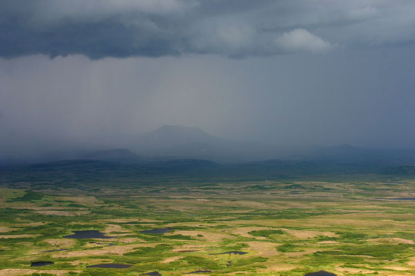
thunderstorm in the Pebble Valley
The storm clouds passed quickly, but the controversy hanging over this valley may remain for years to come. Despite a recent flurry of permit applications, the fate of the area won’t be decided until all the permits are in, perhaps in 2008. If Northern Dynasty prevails, the gold under the tundra may last for a few decades. The wilderness will be gone forever.
A day and a half later we sat under the solid roof of the Nondalton community center, chatting with the village’s environmental coordinator. No longer just words on a map, the names of villages and creeks rolled off my tongue as I eagerly expounded on ways I might help with the effort to stop this mine.
Finally, as the plane took off to return us to Anchorage, I swiveled around to watch Nondalton village disappear beneath me. I wondered what it might look like in the winter, and about all the places touched by Pebble I hadn’t had a chance to visit. I knew I’d be coming back.
Download thepdf version of this essay.
Created: Jan. 19, 2018