Kenai Peninsula Borough Anadromous Streams Ordinance
Last modified: 12th August 2019
Executive Summary
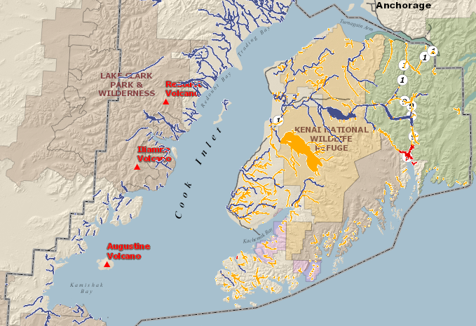
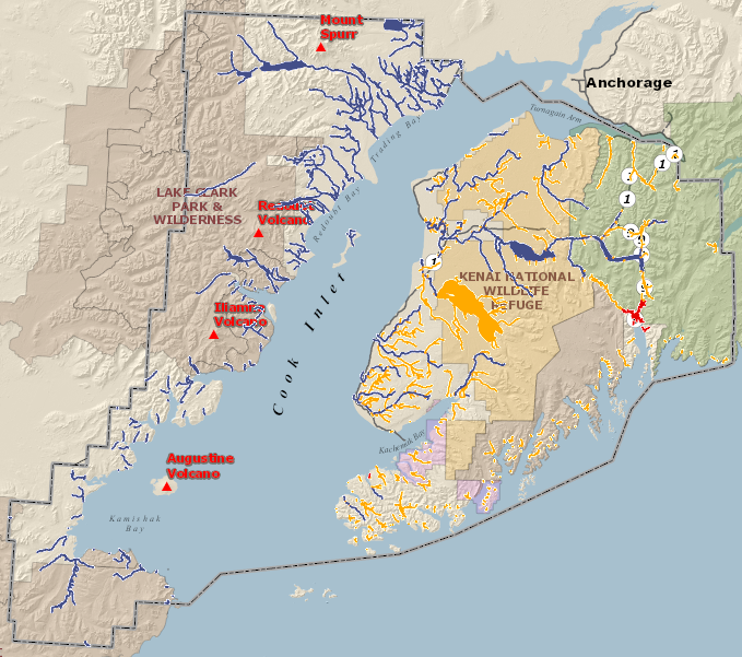
This ordinance establishes a buffer zone of limited development within 50 feet of anadromous (salmon-bearing) waters, to protect fish habitat. Waters are defined based on Fish and Game’s catalog of anadromous waters, with exemptions for the Seward flood area and the Seldovia Slough. They include both rivers and lakes. Shore access structures are allowed with permits, and some additional activities are allowed with conditional use permits. Previously-existing structures are grandfathered in. Activities that don’t involve excavation, fill, or construction are not affected.
Salmon in Cook Inlet (the Kenai Peninsula Borough includes both the Kenai Peninsula and the west side of Cook Inlet) are subject to a number of human-caused stresses, including fishing, development, climate change, and ocean acidification. Fewer salmon can bring severe ecologic and economic impacts to the borough. Notably, poor returns of upper Cook Inlet king salmon caused serious problems for both sport and commercial fishermen in 2012, prompting a disaster declaration in September 2012.
However, protection and improvement of riparian (shoreline) habitat are the only factors under direct control of the borough.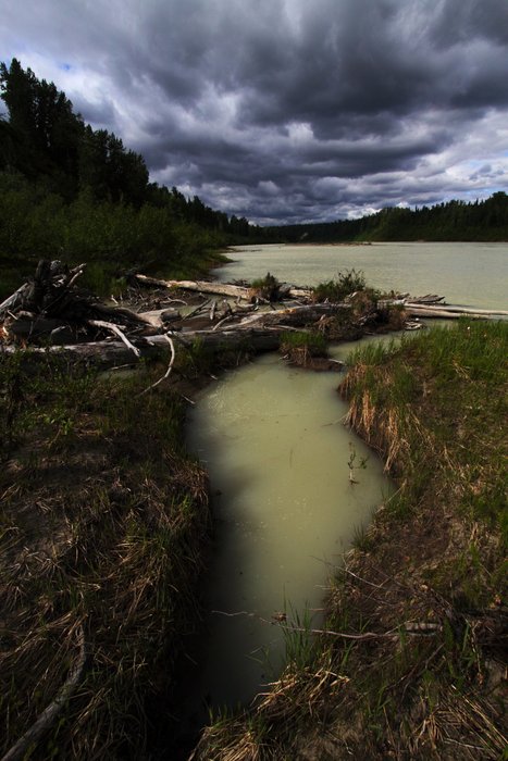
Protected buffer zones around waterways are a common feature of towns and boroughs across Alaska and the US. Studies on buffer width suggest greater benefits are achieved with buffers in the 100-200 foot range, larger than the Kenai Peninsula’s 50 foot zone.
These vegetated buffer zones improve water quality by filtering contaminants, preventing sediment from reaching the stream or lake, and adding nutrients in the form of leaf litter. Vegetation in these buffers shades and cools the water, and creates habitat underneath roots, and in fallen trees and branches. All of these effects are important to spawning and rearing salmon.
By maintaining this habitat in streams and lakes across the borough, a variety of different fish stocks are preserved. A diversity of unique populations is key to the resilience of the regional salmon stock, and buffers against the impacts of year to year variability and long term change.
There has been some opposition to the ordinance, primarily from waterfront property owners. The ordinance was a major issue in the fall 2012 borough elections, where incumbent candidates generally prevailed over opponents seeking to overturn the ordinance.
Although this ordinance does restrict the use of some areas within private property, studies across the country have shown that regulated greenways and stream and lake buffers often provide an overall boost to property values, above the value of similar areas without restrictions.
Benefits of Stream and Lake Buffers
Buffers reduce contaminants reaching streams and lakes. When flowing through a vegetated buffer, water slows down. Contaminants such as oil and bacteria are filtered through the soil, adhere to vegetation, or are degraded by microbes. Fine particles settle out before reaching the water, which allows contaminants (like heavy metals) to settle out with them. Even in the absence of contaminants, this silt removal is critical for fish. Removing riparian vegetation increases sediment loads in streams and lakes, and favors other species at the expense of trout and salmon, which require unsilted spawning areas. Too much silt reduces the amount of oxygen reaching incubating salmon eggs, potentially suffocating them.
In addition to preventing harmful substances from reaching the stream or lake, shoreline vegetation also provides nutrients in the form of leaf litter. This buffer of plants and the nutrients it provides protect the community of invertebrates in the stream, providing food for rearing salmon.
Above-surface vegetation is only one piece of the shoreline ecology. Beneath the surface, a river or lake is continuous with the neighboring “hyporheic zone” - the area around a waterway where the groundwater is connected to the surface water. Aquatic microbes, insect larvae, and even small fish can swim through the spaces between rocks in the hyporheic zone. These organisms can consume excess nitrogen and decompose organic matter.
Vegetation also plays an important role in maintaining ideal water temperatures. In small streams, trees and brush shade and cool the water. In larger rivers and lakes, shaded banks form cool refuges for fish on hot days. In both cases, plants shade the soil, cooling the water that enters the river or lake through groundwater in the hyporheic zone.
These buffer functions are critical to maintain a stream or lake as habitat for rearing and spawning salmon. Salmon are a cold water species. Temperature requirements vary between different salmon species and life stages, with the most sensitive being egg incubation (harmed above 10 degrees C, 50 degrees F) and smoltification (harmed in temperatures above 11-13 degrees C, 52-55 degrees F), and the least sensitive being adult migration (harmed in temperatures above 21-23 degrees C, 70-73 degrees F). The state of Alaska has set water temperature criteria at 13 degrees C for spawning and incubation areas, and at 15 degrees for rearing and migration areas. Cold water also holds more oxygen than warm water, which is additionally important for salmon.
Other Concerns
Warming Streams: As a result of human-caused climate change, temperatures have been rising in streams around Cook Inlet. Presently,non-glacial salmon streams in the Cook Inlet watershed consistently exceed Alaska’s water quality criteria set for the protection of fish. Based on a regional assessment of 48 streams, summer temperatures exceeded the state’s 13 degrees C water temperature criteria for spawning and incubating salmon in 35 in 2008, 47 sites in 2009, and 39 sites in 2010. Temperatures exceeded 20 degrees C, a level at which they begin to threaten adult salmon, at 3 sites in 2008, 17 sites in 2009, and one site in 2010. Using historical air temperature information, it is clear that stream temperatures are warmer now than in the recent past. And with air temperatures predicted to rise as much as 5 degrees C, this warming water temperature trend will likely continue.
Warming Ocean: Higher ocean temperatures also harm salmon. Temperature increases in the Gulf of Alaska have been minor so far, but are expected to increase greatly in coming decades, reducing available habitat for salmon. Under a “medium” emissions scenario, ocean habitats for salmon are projected to decrease 30-86% by 2100. This includes a nearly complete loss of Gulf of Alaska habitat for red salmon in summer and winter, and king salmon in summer.
Ocean Acidification: In addition to raising atmospheric temperature, over a third of the carbon dioxide released by burning fossil fuels has been absorbed into the ocean. Dissolved carbon dioxide makes the ocean more acidic. Because cold waters absorb more gases than warm ones, this effect is especially strong in northern areas like Alaska. This acidity makes it harder for shell-building organisms to build their shells. This impacts important food sources for salmon, such as pteropods (swimming snails), which can be up to half a pink salmon’s diet. Some sites in the Gulf of Alaska are already too acidic for pteropod shell formation. Additionally, studies on some fish species (salmon have not been studied) have shown that dissolved carbon dioxide impairs their directional sense and ability to avoid predators.
Conclusion
Multiple stresses compound, making salmon more vulnerable to each additional stressor. Fish weakened by high temperature, insufficient food, or damaged habitat are more susceptible to predators and diseases. The Kenai Peninsula Borough Anadromous Streams Ordinance will not affect many of these potential stresses, but may have a positive impact on salmon populations in Cook Inlet. Although the ordinance will impact the ability of waterfront property owners to build within 50 feet of the water, similar restrictions in other locations have had a positive impact on property values.
Created: Jan. 19, 2018