1893 Russell map of Fountain Stream
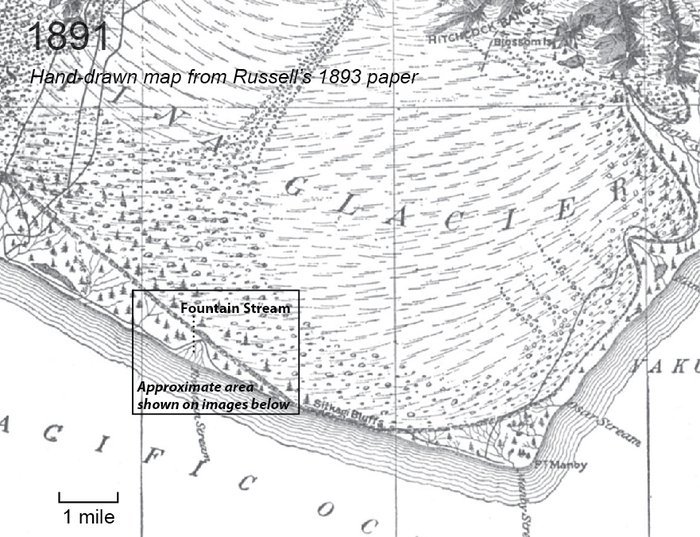
Israel Russell recounts his 1890 and 1891 National Geographic supported scientific expeditions to Malaspina Glacier in an extensive paper. From his 1891 visit to Fountain Stream:
"The largest and most remarkable of these springs is the one indicated on the accompanying map as Fountain stream. This comes to the surface through a rudely circular opening, nearly 100 feet in diameter, surrounded in part by ice. Owing to the pressure to which the waters are subjected they boil up violently, and are thrown into the air to the height of 12 to 15 feet, and send jets of spray several feet higher. The waters are brown with sediment, and rush seaward with great rapidity, forming a roaring stream, fully 200 feet broad, which soon divides into many branches, and is spreading a sheet of gravel and sand right and left into the adjacent forest. Where Fountain stream rises, the face of the glacier is steep and covered with huge bowlders, many of which are too large for the waters to move. The finer material has been washed away, however, and a slight recession in the face of the ice bluff has resulted." - Russell, 1893
It's clear the stream was providing abundant sediment, to the point of burying surrounding forest, and delivering much of this sediment to the ocean where it could feed the progradation of beaches. It's likely this sediment provided the material to build extensive beach ridge plains visible in the images above west of Fountain Stream.